
Day 40, End of the Motatapu Track
February 8, 2026
Roses Hut to Arrowtown
TA km marker 2682.5 to 2705.7
Hiked today: 26.2 km
We had a friendly crew in Roses Hut and enjoyed chatting and playing cards to pass the time until dinner and bed. Some time during the night it started to rain, and it was good to be warm and dry inside listening to it. Somebody’s alarm woke us at 6 and we were up and out hiking by 6.30. Although the rain had stopped, we were quickly soaked from feet to thighs from the wet vegetation that we brushed past.
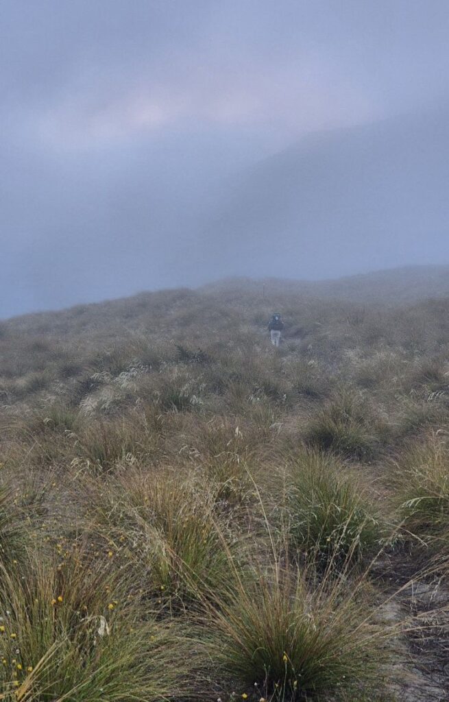
The clouds were still low and, as we ascended, the fog and mist added moisture to our upper bodies. With a cool breeze blowing we were soon quite cold and kept hoping the sun would break through the clouds to warm us. It was a long ascent again to Roses saddle at 1270m, 570 m higher than Roses Hut where we started.
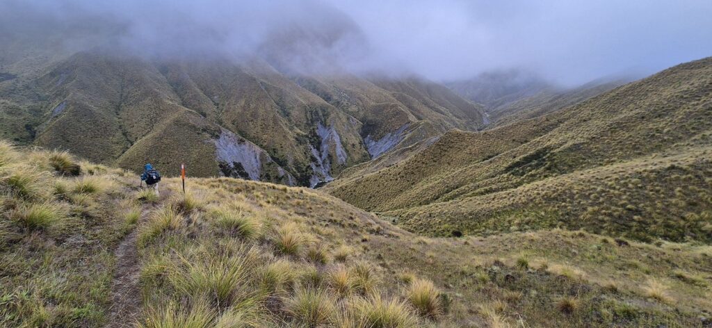
Unfortunately, with the low clouds, we missed the views that we know would have been amazing, both from the saddle and from the lovely ridge which followed. The downward track to the river was not too steep, and the path was wide and clear.
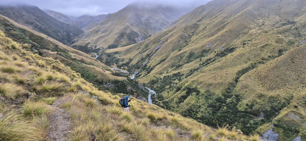
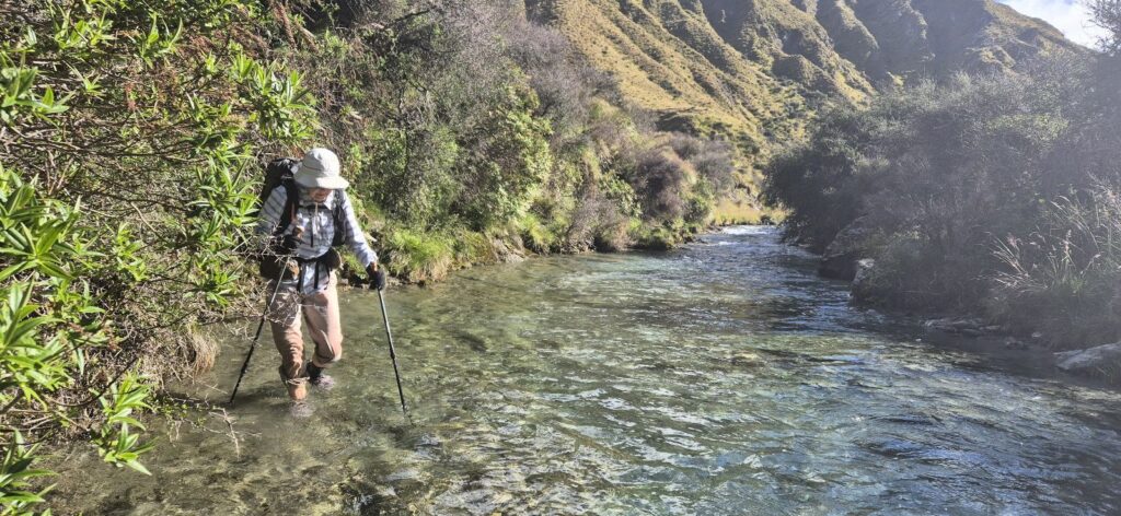
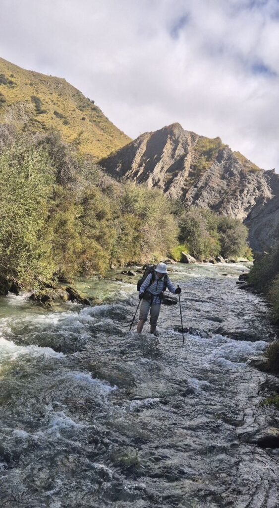
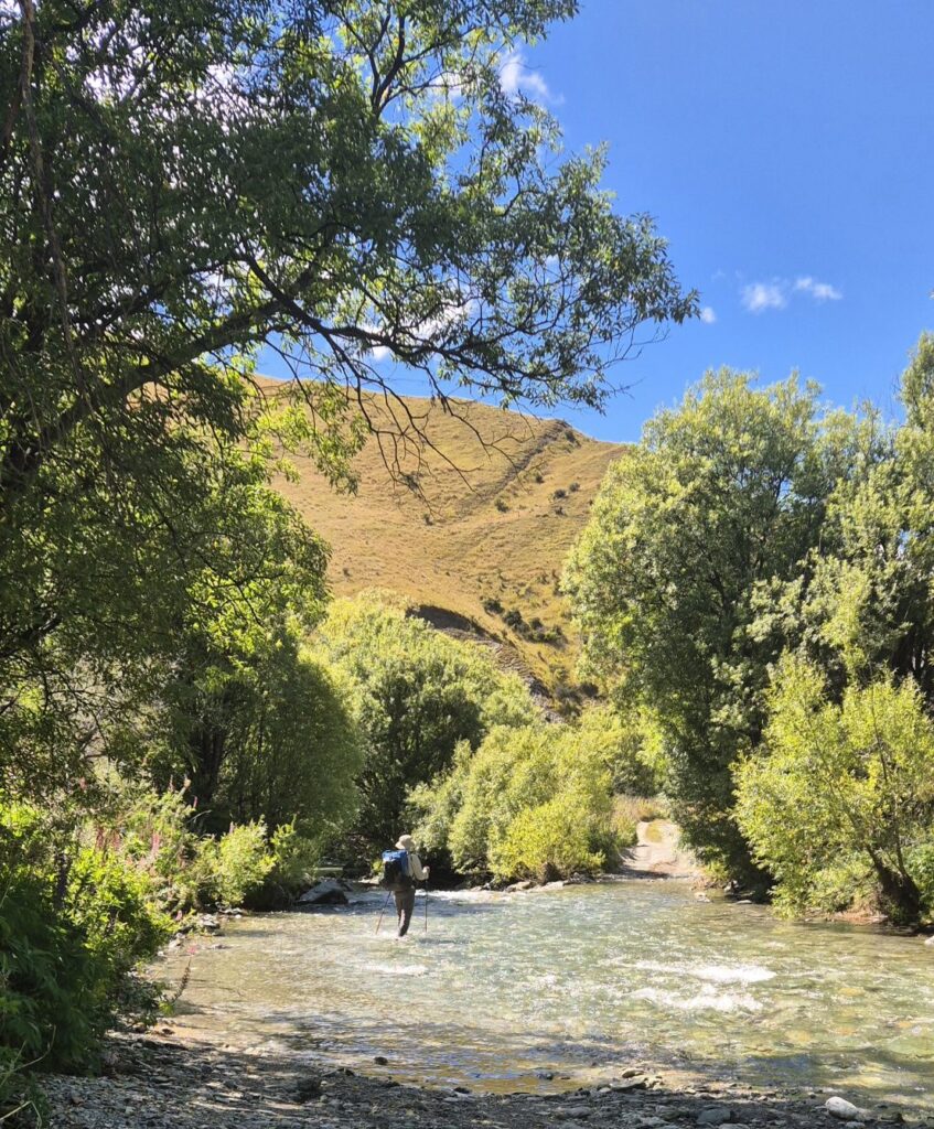
The next stage of today’s track was to make our way along Arrow River, both through the water, and, occasionally along the banks, for 4 km. Fortunately by now the sun was out and helped to warm us, but the river water was typically cold from the alpine streams.
This took us to the historic ruins of Macetown, previously a mining town where there had been a settlement supporting the gold mining. We sat near the restored hut to eat a light lunch and then set off on the 4WD track to Arrowtown. The last couple of km we were able to walk on a nice track through beech forest. And so we completed the Motatapu section of trail – challenging but very rewarding with beautiful views every day from the hilltops.
We have a cabin in a caravan park and have managed to clean all our gear. The other town chores (mainly cleaning and laundry) are done. Tomorrow we have the stretch to Frankton and Queenstown.